Although lidar as a technology has been around for quite some time, development has been so rapid in recent years that it all seems to be in its infancy. Trends show lidar is becoming more affordable and easier to use for various applications. And more and more applications are being added.
Expert Ad Mulders, account manager at Sentech, shares his knowledge in this blog post, with the goal of helping anyone considering getting started with a lidar solution make better decisions.
Lidar solutions involve much more than the installation of the physical hardware. It needs engineering, the software surrounding it, and integration with a customer's specific needs. Ad Mulders: "For us, it always starts with listening to a customer's needs. What follows is an advisory process, often preceded by an initial introduction to the many possibilities of lidar. After all, not all potential customers already have experience with it. With that, we can help them get started."
If those conversations lead to a concrete project, it first comes down to testing the chosen lidar solution and then delivering the hardware and integrating it into the customer's systems. Sometimes, that also means modifying cabling or adding specific connectors. "Sensor fusion, integration of the components, that's our added value. It is usually the customer who controls the algorithms, although we do not rule out Sentech playing a somewhat more prominent role in this in the future," says Mulders.
Lidar projects
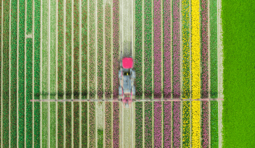
Typical lidar projects revolve around robotics, Automated Guided Vehicles (AGVs), or specific inspections. Think of AGVs in controlled environments such as large warehouses and in agriculture and horticulture, where the AGVs in and around stables and fields detect objects and obstacles in their environment. Or 'mobile mapping', where a lidar sensor maps the environment. Mulders: "Thanks to lidar, whether or not in combination with a camera and a GPS unit, you create an accurate image of the environment. It can be an isolated object, such as a road connection or the infrastructure of fiber optic cabling, but also, for example, an entire urban area."
Inspecting a bridge, for example, becomes more accurate and accessible thanks to lidar. You mount a 360-degree lidar under a drone and get to places you normally can't easily reach. The 3D images you create with it give you a direct view of any weaknesses. After which you can really zoom in with the camera.
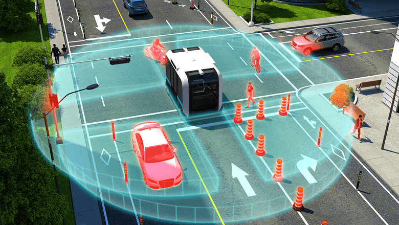
The possibilities for lidar are virtually unlimited. Mulders sees an important development in intelligent traffic systems. "There, lidar could offer a strong alternative to today's solutions that require a lot of maintenance and - with loops in the road - are also very expensive. For every adjustment or repair, an entire intersection has to be turned off, creating new problems. With lidar, combined with a software platform developed specifically for this purpose, this can all be done much more simply: one can use it to map an entire traffic intersection in real-time. Including all movements and all relevant data that emerge from them. Monitoring, counting, and analyzing all the pedestrian, bicycle, bus, and car traffic really comes into focus this way."
Before these intelligent traffic systems become a sizeable growth market, many discussions are still needed with all stakeholders, such as governments, project developers, contractors, and road construction companies. Not surprisingly, it often takes a bit of persuasion to convince parties who have been working in a certain way for years of the benefits of a changed approach. Mulders is working hard to get this done and is convinced that the change is only a matter of time. "Especially since the benefits in time, money, and quality are obvious."
Velodyne and Ouster
It is important to choose the right brands for each hardware solution. A customer's specific situation determines this. As Velodyne and Ouster's partner for the Netherlands, Sentech knows exactly what can be achieved with these companies’ solutions. Since the merger between the two, Ouster has improved its visibility, Mulders notes. "This is also because Ouster is a bit more advanced in digitizing lidar hardware, with advantages in terms of distance and accuracy."
![Lidar OS1-5[18]](https://e.sentech.nl/hs-fs/hubfs/Lidar%20OS1-5%5B18%5D.jpg?width=3400&height=2300&name=Lidar%20OS1-5%5B18%5D.jpg)
Ouster has the most advanced hardware and develops and manufactures its own chips that, among other things, ensure that the resolution of the delivered image is much better. Mulders: "So what we now see regularly is customers giving their existing lidar sensors a substantial upgrade with Ouster's digital lidar sensors. This fortunately requires relatively little modification, but the result is much better."

How to integrate lidar in your vehicle?
How do you start with the integration of lidar? There are several lidar technologies on the market. The speed of the vehicle and the reflectivity of environmental objects determine the required field of view. Therefore what technology is needed to make your vehicle drive in complete safety and autonomously.
In this 5-step plan you can see what a lidar integration process looks like.